
Tbilisi topographic map
Click on the map to display elevation.
Tbilisi
Most of the raions are named after historic quarters of the city. The citizens of Tbilisi widely recognise an informal system of smaller historic neighbourhoods. Such neighbourhoods are several, however, constituting a kind of hierarchy, because most of them have lost their distinctive topographic limits. The natural first level of subdivision of the city is into the Right Bank and the Left Bank of the Mt'k'vari. The names of the oldest neighbourhoods go back to the early Middle Ages and sometimes pose a great linguistic interest. The newest whole-built developments bear chiefly residential marketing names.
About this map
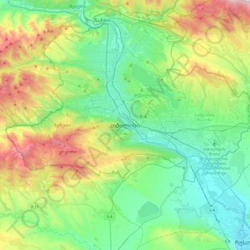
Name: Tbilisi topographic map, elevation, terrain.
Location: Tbilisi, 0136, Georgia (41.53346 44.64145 41.85346 44.96145)
Average elevation: 2,339 ft
Minimum elevation: 1,047 ft
Maximum elevation: 5,676 ft