
Rhosllanerchrugog topographic map
Interactive map
Click on the map to display elevation.
About this map
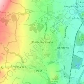
Name: Rhosllanerchrugog topographic map, elevation, terrain.
Location: Rhosllanerchrugog, Wrexham, Wales, LL14 2LH, United Kingdom (52.97273 -3.09942 53.05273 -3.01942)
Average elevation: 627 ft
Minimum elevation: 203 ft
Maximum elevation: 1,572 ft