
Golegã topographic map
Interactive map
Click on the map to display elevation.
About this map
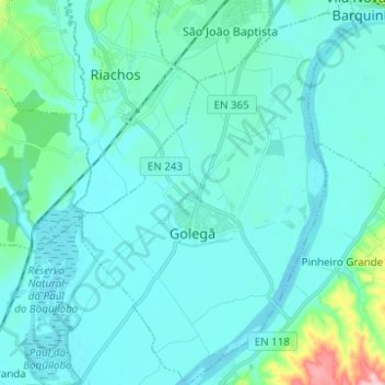
Name: Golegã topographic map, elevation, terrain.
Location: Golegã, Santarém, Lezíria do Tejo, Alentejo, Portugal (39.36401 -8.52231 39.45966 -8.43454)
Average elevation: 92 ft
Minimum elevation: 30 ft
Maximum elevation: 571 ft