
Solling topographic map
Interactive map
Click on the map to display elevation.
About this map
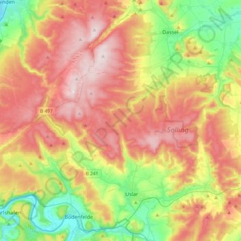
Name: Solling topographic map, elevation, terrain.
Location: Solling, Northeim (arrondissement), Basse-Saxe, Allemagne (51.62841 9.41757 51.81880 9.76152)
Average elevation: 991 ft
Minimum elevation: 308 ft
Maximum elevation: 1,739 ft