
Narayanganj topographic map
Interactive map
Click on the map to display elevation.
About this map
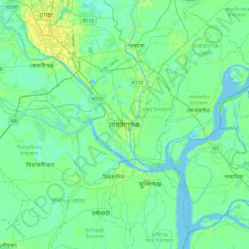
Name: Narayanganj topographic map, elevation, terrain.
Average elevation: 20 ft
Minimum elevation: -13 ft
Maximum elevation: 69 ft
Other topographic maps
Click on a map to view its topography, its elevation and its terrain.
Sheikh Rasel Nogor Park
Bangladesh > Dhaka Division > Narayanganj
Sheikh Rasel Nogor Park, Aamhatta (Jallarpar), Narayanganj, Narayangonj district, Dhaka Division, Bangladesh
Average elevation: 26 ft