
Loncin topographic map
Interactive map
Click on the map to display elevation.
About this map
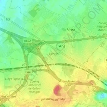
Name: Loncin topographic map, elevation, terrain.
Location: Loncin, Ans, Liège, Wallonie, 4430, Belgique (50.64515 5.48273 50.68515 5.52273)
Average elevation: 568 ft
Minimum elevation: 469 ft
Maximum elevation: 709 ft
Other topographic maps
Click on a map to view its topography, its elevation and its terrain.
Xhendremael
Belgique > Liège > Liège > Ans
Xhendremael, Ans, Liège, Wallonie, 4430, Belgique
Average elevation: 479 ft