
খুরুশকুল topographic map
Interactive map
Click on the map to display elevation.
About this map
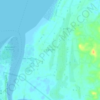
Name: খুরুশকুল topographic map, elevation, terrain.
Location: খুরুশকুল, কক্সবাজার জেলা, Chittagong, ৪৭০০, Bangladés (21.45250 91.96632 21.49250 92.00632)
Average elevation: 16 ft
Minimum elevation: -23 ft
Maximum elevation: 115 ft