
Rudry topographic map
Interactive map
Click on the map to display elevation.
About this map
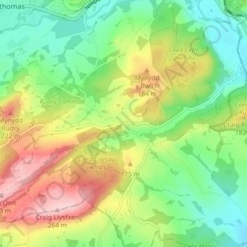
Name: Rudry topographic map, elevation, terrain.
Location: Rudry, Caerphilly, Wales, CF83 3DE, United Kingdom (51.55272 -3.17354 51.59272 -3.13354)
Average elevation: 407 ft
Minimum elevation: 108 ft
Maximum elevation: 873 ft