
Thermopylae topographic map
Interactive map
Click on the map to display elevation.
About this map
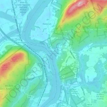
Name: Thermopylae topographic map, elevation, terrain.
Average elevation: 249 ft
Minimum elevation: 82 ft
Maximum elevation: 902 ft
Other topographic maps
Click on a map to view its topography, its elevation and its terrain.
South Hadley
United States > Massachusetts > Hampshire County > South Hadley
South Hadley, Hampshire County, Massachusetts, 01075, United States
Average elevation: 276 ft