
Claridon topographic map
Interactive map
Click on the map to display elevation.
About this map
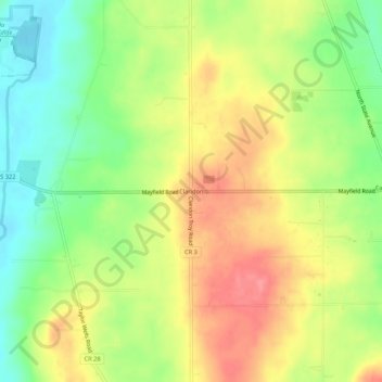
Name: Claridon topographic map, elevation, terrain.
Location: Claridon, Claridon Township, Geauga County, Ohio, 44033, USA (41.51218 -81.16410 41.55218 -81.12410)
Average elevation: 1,243 ft
Minimum elevation: 1,112 ft
Maximum elevation: 1,371 ft