
Presidente Perón topographic map
Interactive map
Click on the map to display elevation.
About this map
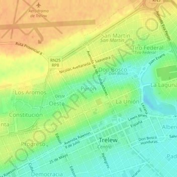
Name: Presidente Perón topographic map, elevation, terrain.
Average elevation: 79 ft
Minimum elevation: 20 ft
Maximum elevation: 135 ft
Other topographic maps
Click on a map to view its topography, its elevation and its terrain.
Parque recreativo Laguna Chiquichano
Parque recreativo Laguna Chiquichano, La Laguna, Trelew, Departamento Rawson, Chubut, U9100, Argentina
Average elevation: 62 ft