
Diana topographic map
Interactive map
Click on the map to display elevation.
About this map
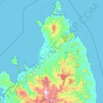
Name: Diana topographic map, elevation, terrain.
Location: Diana, Antsiranana Province, Madagascar (-14.26535 47.85831 -11.95203 49.66638)
Average elevation: 696 ft
Minimum elevation: 0 ft
Maximum elevation: 9,272 ft
Other topographic maps
Click on a map to view its topography, its elevation and its terrain.
Ambilobe
Madagascar > Diana > Ambilobe
Ambilobe, Diana, Antsiranana Province, Madagascar
Average elevation: 151 ft