
El Mazuco topographic map
Interactive map
Click on the map to display elevation.
About this map
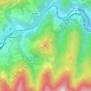
Name: El Mazuco topographic map, elevation, terrain.
Location: El Mazuco, Zalla, Vizcaya, País Vasco, 48800, España (43.19322 -3.17523 43.19332 -3.17513)
Average elevation: 961 ft
Minimum elevation: 351 ft
Maximum elevation: 2,064 ft