
Elsenz topographic map
Interactive map
Click on the map to display elevation.
About this map
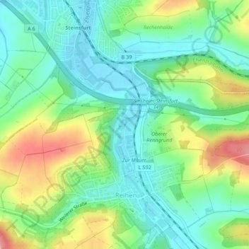
Name: Elsenz topographic map, elevation, terrain.
Average elevation: 663 ft
Minimum elevation: 548 ft
Maximum elevation: 879 ft
Other topographic maps
Click on a map to view its topography, its elevation and its terrain.
Hilsbach
Deutschland > Baden-Württemberg > Sinsheim
Hilsbach, Sinsheim, Verwaltungsgemeinschaft Sinsheim, Rhein-Neckar-Kreis, Regierungsbezirk Karlsruhe, Baden-Württemberg, Deutschland
Average elevation: 741 ft
Waldangelloch
Deutschland > Baden-Württemberg > Sinsheim
Waldangelloch, Sinsheim, Verwaltungsgemeinschaft Sinsheim, Rhein-Neckar-Kreis, Regierungsbezirk Karlsruhe, Baden-Württemberg, Deutschland
Average elevation: 751 ft