
Cerro Castellan topographic map
Interactive map
Click on the map to display elevation.
About this map
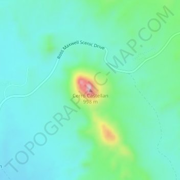
Name: Cerro Castellan topographic map, elevation, terrain.
Location: Cerro Castellan, Brewster County, Texas, Estados Unidos (29.14460 -103.49745 29.14470 -103.49735)
Average elevation: 2,333 ft
Minimum elevation: 2,129 ft
Maximum elevation: 3,127 ft
Other topographic maps
Click on a map to view its topography, its elevation and its terrain.
Rio Grande
Rio Grande, Brewster County, Texas, 88006, Estados Unidos
Average elevation: 3,419 ft