
Ouled Ali topographic map
Interactive map
Click on the map to display elevation.
About this map
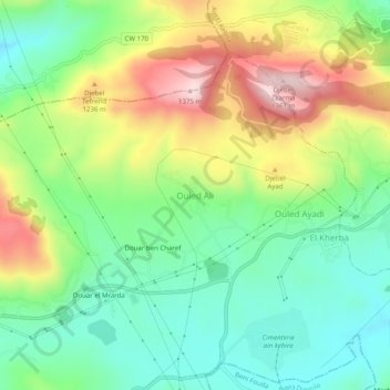
Name: Ouled Ali topographic map, elevation, terrain.
Location: Ouled Ali, Daïra Aïn El Kebira, Sétif, 19058, Algérie (36.32880 5.45021 36.36880 5.49021)
Average elevation: 3,675 ft
Minimum elevation: 3,205 ft
Maximum elevation: 4,446 ft