
Christchurch topographic map
Click on the map to display elevation.
About this map
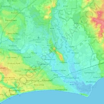
Name: Christchurch topographic map, elevation, terrain.
Average elevation: 59 ft
Minimum elevation: -13 ft
Maximum elevation: 266 ft
Other topographic maps
Click on a map to view its topography, its elevation and its terrain.
East Parley Common
United Kingdom > England > Bournemouth, Christchurch and Poole > Hurn
Average elevation: 43 ft