
Meziboří topographic map
Interactive map
Click on the map to display elevation.
About this map
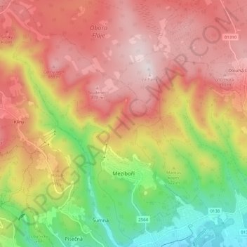
Name: Meziboří topographic map, elevation, terrain.
Location: Meziboří, okres Most, Ústecký kraj, Northwest, Czechia (50.60224 13.55381 50.66645 13.63100)
Average elevation: 2,182 ft
Minimum elevation: 1,056 ft
Maximum elevation: 3,097 ft