
Nehru Nagar topographic map
Interactive map
Click on the map to display elevation.
About this map
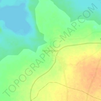
Name: Nehru Nagar topographic map, elevation, terrain.
Location: Nehru Nagar, Kurnool, Andhra Pradesh, India (15.94580 78.26191 15.98580 78.30191)
Average elevation: 906 ft
Minimum elevation: 850 ft
Maximum elevation: 965 ft