
Bin El Ouidane topographic map
Interactive map
Click on the map to display elevation.
About this map
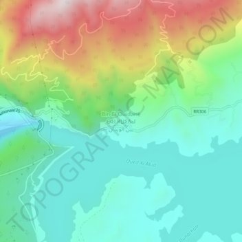
Name: Bin El Ouidane topographic map, elevation, terrain.
Average elevation: 3,173 ft
Minimum elevation: 2,336 ft
Maximum elevation: 4,934 ft
Other topographic maps
Click on a map to view its topography, its elevation and its terrain.
Barrage Bin el Ouidane
Maroc > cercle d'Ouaouizeght > Bin El Ouidane
Barrage Bin el Ouidane, Bin El Ouidane, caïdat d'Ouaouizeght, cercle d'Ouaouizeght, Province d'Azilal, Béni Mellal-Khénifra, Maroc
Average elevation: 3,041 ft