
Belaa topographic map
Interactive map
Click on the map to display elevation.
About this map
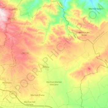
Name: Belaa topographic map, elevation, terrain.
Location: Belaa, Daïra Bir El Arch, Sétif, RADP (36.14488 5.77372 36.29653 5.96398)
Average elevation: 3,366 ft
Minimum elevation: 2,290 ft
Maximum elevation: 4,482 ft