
Thank you for supporting this site ❤️
Make a donation
Make a donation
Gear up for your next adventure:
As an Amazon Associate, this site earns from qualifying purchases at no extra cost to you.
Gate 5 topographic map
Click on the map to display elevation.
Thank you for supporting this site ❤️
Make a donation
Make a donation
Gear up for your next adventure:
As an Amazon Associate, this site earns from qualifying purchases at no extra cost to you.
About this map
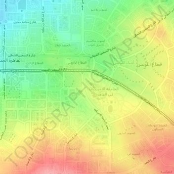
Name: Gate 5 topographic map, elevation, terrain.
Location: Gate 5, New Cairo City, Cairo, 11865, Egypt (30.00151 31.47683 30.04151 31.51683)
Average elevation: 1,040 ft
Minimum elevation: 869 ft
Maximum elevation: 1,214 ft
Thank you for supporting this site ❤️
Make a donation
Make a donation
Gear up for your next adventure:
As an Amazon Associate, this site earns from qualifying purchases at no extra cost to you.