
Santa Rosa topographic map
Interactive map
Click on the map to display elevation.
About this map
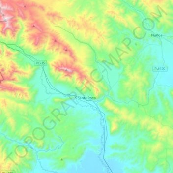
Name: Santa Rosa topographic map, elevation, terrain.
Location: Santa Rosa, Melgar, Puno, Peru (-14.75847 -70.99935 -14.40908 -70.62614)
Average elevation: 14,058 ft
Minimum elevation: 12,838 ft
Maximum elevation: 17,835 ft