
Tsabit topographic map
Interactive map
Click on the map to display elevation.
About this map
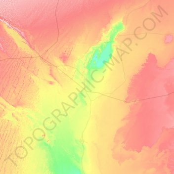
Name: Tsabit topographic map, elevation, terrain.
Location: Tsabit, Daïra de Tsabit, Adrar, 01015, Algérie (28.17927 -2.57574 28.98090 0.01686)
Average elevation: 1,066 ft
Minimum elevation: 561 ft
Maximum elevation: 1,857 ft
Other topographic maps
Click on a map to view its topography, its elevation and its terrain.
Hammad
Algérie > Adrar > Daïra de Tsabit > Tsabit
Hammad, Tsabit, Daïra de Tsabit, Adrar, 01015, Algérie
Average elevation: 804 ft