
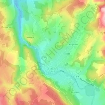
Le Malzieu-Ville topographic map
Interactive map
Click on the map to display elevation.
About this map
Name: Le Malzieu-Ville topographic map, elevation, terrain.
Average elevation: 3,009 ft
Minimum elevation: 2,733 ft
Maximum elevation: 3,366 ft
Other topographic maps
Click on a map to view its topography, its elevation and its terrain.
La Brugerette
Frankrijk > Occitanië > Lozère > Le Malzieu-Ville
La Brugerette, Le Malzieu-Ville, Mende, Lozère, Occitanië, Metropolitaans Frankrijk, 48140, Frankrijk
Average elevation: 3,071 ft