
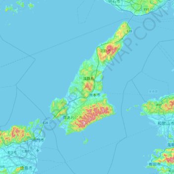
淡路島 topographic map
Interactive map
Click on the map to display elevation.
About this map
Name: 淡路島 topographic map, elevation, terrain.
Location: 淡路島, Sumoto, 洲本市, Prefectura de Hyōgo, 近畿地方, Japón (34.04538 134.50615 34.68538 135.14615)
Average elevation: 75 ft
Minimum elevation: -13 ft
Maximum elevation: 1,909 ft