
Fleuve Churchill topographic map
Interactive map
Click on the map to display elevation.
About this map
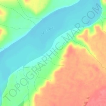
Name: Fleuve Churchill topographic map, elevation, terrain.
Location: Fleuve Churchill, Neufundland und Labrador, Kanada (53.06687 -61.14656 53.06812 -61.14480)
Average elevation: 161 ft
Minimum elevation: 62 ft
Maximum elevation: 295 ft
Other topographic maps
Click on a map to view its topography, its elevation and its terrain.
St. Paul's
Kanada > Neufundland und Labrador
St. Paul's, Neufundland, Neufundland und Labrador, A0K 4Y0, Kanada
Average elevation: 16 ft
Mobile River
Kanada > Neufundland und Labrador > St. John's
Mobile River, St. John's, Neufundland und Labrador, Kanada
Average elevation: 243 ft
Churchill Falls
Kanada > Neufundland und Labrador > Churchill Falls
Churchill Falls, Labrador, Neufundland und Labrador, Kanada
Average elevation: 1,119 ft