
Kuttichal topographic map
Interactive map
Click on the map to display elevation.
About this map
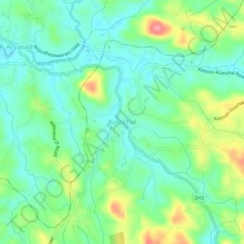
Name: Kuttichal topographic map, elevation, terrain.
Location: Kuttichal, Kattakkada, Thiruvananthapuram, Kerala, 695574, India (8.54721 77.08149 8.58721 77.12149)
Average elevation: 272 ft
Minimum elevation: 171 ft
Maximum elevation: 492 ft
Other topographic maps
Click on a map to view its topography, its elevation and its terrain.
Tachottukavu
India > Kerala > Kattakkada > Tachottukavu
Tachottukavu, Kattakkada, Thiruvananthapuram, Kerala, 695573, India
Average elevation: 171 ft
Uriyacode
India > Kerala > Kattakkada > Uriyacode
Uriyacode, Kattakkada, Thiruvananthapuram, Kerala, 695543, India
Average elevation: 295 ft