
Thank you for supporting this site ❤️
Make a donation
Make a donation
Gear up for your next adventure:
As an Amazon Associate, this site earns from qualifying purchases at no extra cost to you.
Uriyacode topographic map
Click on the map to display elevation.
Thank you for supporting this site ❤️
Make a donation
Make a donation
Gear up for your next adventure:
As an Amazon Associate, this site earns from qualifying purchases at no extra cost to you.
About this map
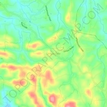
Name: Uriyacode topographic map, elevation, terrain.
Location: Uriyacode, Kattakkada, Thiruvananthapuram, Kerala, 695543, India (8.53099 77.04658 8.57099 77.08658)
Average elevation: 295 ft
Minimum elevation: 151 ft
Maximum elevation: 515 ft
Thank you for supporting this site ❤️
Make a donation
Make a donation
Gear up for your next adventure:
As an Amazon Associate, this site earns from qualifying purchases at no extra cost to you.