
Schönstädt topographic map
Interactive map
Click on the map to display elevation.
About this map
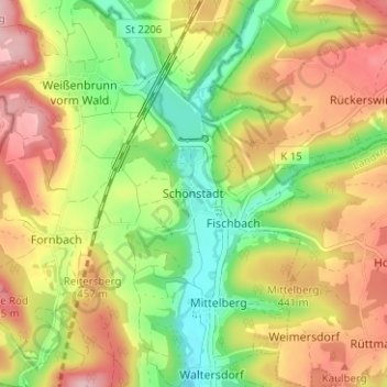
Name: Schönstädt topographic map, elevation, terrain.
Location: Schönstädt, Landkreis Coburg, Oberfranken, Bayern, Deutschland (50.32385 11.00849 50.36385 11.04849)
Average elevation: 1,355 ft
Minimum elevation: 1,060 ft
Maximum elevation: 1,670 ft