
Guangxi topographic map
Interactive map
Click on the map to display elevation.
About this map
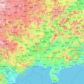
Name: Guangxi topographic map, elevation, terrain.
Location: Guangxi, China (20.70300 104.44824 26.38639 112.05690)
Average elevation: 1,302 ft
Minimum elevation: -10 ft
Maximum elevation: 7,106 ft
Other topographic maps
Click on a map to view its topography, its elevation and its terrain.