
Nazaré topographic map
Interactive map
Click on the map to display elevation.
About this map
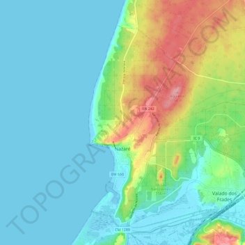
Name: Nazaré topographic map, elevation, terrain.
Location: Nazaré, Leiria, West, Centro, Portugal (39.57443 -9.08607 39.65012 -8.97096)
Average elevation: 128 ft
Minimum elevation: -3 ft
Maximum elevation: 518 ft