
Delyankir topographic map
Interactive map
Click on the map to display elevation.
About this map
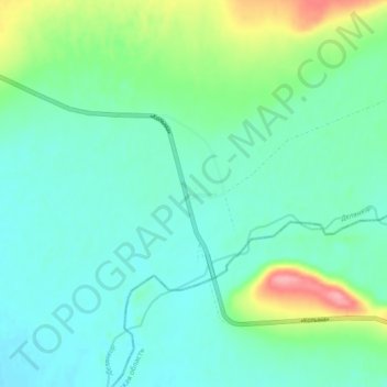
Name: Delyankir topographic map, elevation, terrain.
Average elevation: 2,664 ft
Minimum elevation: 2,585 ft
Maximum elevation: 2,913 ft
Other topographic maps
Click on a map to view its topography, its elevation and its terrain.
Oymyakon
Russia > Sakha Republic > Oymyakonsky Ulus > Oymyakon
Oymyakon, Борогонский 1-й наслег, Oymyakonsky Ulus, Sakha Republic, Far Eastern Federal District, Russia
Average elevation: 2,228 ft