
Moussadek topographic map
Interactive map
Click on the map to display elevation.
About this map
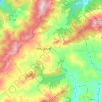
Name: Moussadek topographic map, elevation, terrain.
Location: Moussadek, Daïra El Marsa, Chlef, Algérie (36.30108 0.96523 36.40093 1.08393)
Average elevation: 1,591 ft
Minimum elevation: 659 ft
Maximum elevation: 2,848 ft
Other topographic maps
Click on a map to view its topography, its elevation and its terrain.
El Marsa
Algérie > Chlef > Daïra El Marsa
El Marsa, Daïra El Marsa, Chlef, Algérie
Average elevation: 692 ft