
Thank you for supporting this site ❤️
Make a donation
Make a donation
Gear up for your next adventure:
As an Amazon Associate, this site earns from qualifying purchases at no extra cost to you.
Panes topographic map
Click on the map to display elevation.
Thank you for supporting this site ❤️
Make a donation
Make a donation
Gear up for your next adventure:
As an Amazon Associate, this site earns from qualifying purchases at no extra cost to you.
About this map
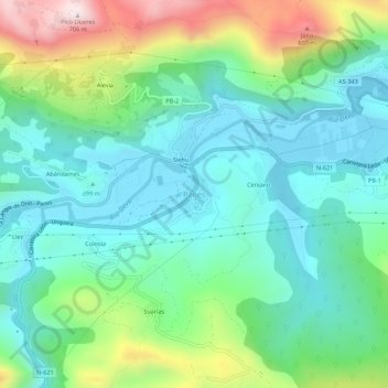
Name: Panes topographic map, elevation, terrain.
Location: Panes, Peñamellera Baja, Asturias, 33570, Spain (43.30342 -4.60399 43.34342 -4.56399)
Average elevation: 643 ft
Minimum elevation: 33 ft
Maximum elevation: 2,254 ft
Thank you for supporting this site ❤️
Make a donation
Make a donation
Gear up for your next adventure:
As an Amazon Associate, this site earns from qualifying purchases at no extra cost to you.