Geolocate
👉 Easily get elevation data in JSON, GeoTIFF and KML formats using Elevation API
Thank you for supporting this site ❤️
Make a donation

Collins topographic map

Click on the map to display elevation.

👉 Easily get elevation data in JSON, GeoTIFF and KML formats using Elevation API
Thank you for supporting this site ❤️
Make a donation

About this map

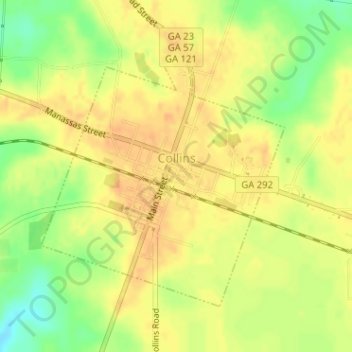
Name: Collins topographic map, elevation, terrain.

Location: Collins, Tattnall County, Georgia, 30421, United States (32.16988 -82.12129 32.18984 -82.09922)

Average elevation: 220 ft

Minimum elevation: 148 ft

Maximum elevation: 253 ft

Tattnall County trails, hiking, mountain biking, running and outdoor activities

Gear up for your next adventure:

🌡️Handheld Weather Meters - Measure wind, temp, and pressure for safe mountain travel
🧭Outdoor Navigation Book - Learn advanced navigation skills
🪶Camp Gear Gift Set - Perfect gift bundle for outdoor fans
🪑Portable Camp Table - Compact table for campsite meals
🧭Map Reading Tools - Tools and kits for map navigation

As an Amazon Associate, this site earns from qualifying purchases at no extra cost to you.