
Malthi topographic map
Interactive map
Click on the map to display elevation.
About this map
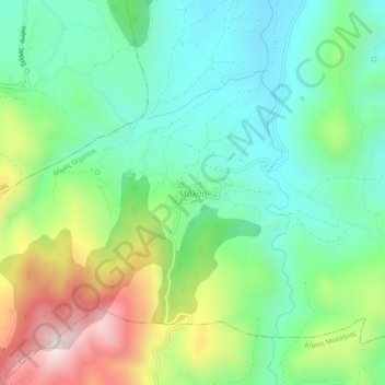
Name: Malthi topographic map, elevation, terrain.
Average elevation: 1,280 ft
Minimum elevation: 541 ft
Maximum elevation: 2,828 ft
Other topographic maps
Click on a map to view its topography, its elevation and its terrain.
Κυπαρισσία
Greece > Peloponnese, Western Greece and the Ionian > Messenia Regional Unit > Kyparissia Municipal Unit
Κυπαρισσία, Kyparissia Municipal Unit, Municipality of Trifylia, Messenia Regional Unit, Peloponnese Region, Peloponnese, Western Greece and the Ionian, 245 00, Greece
Average elevation: 499 ft
Mavromati
Greece > Peloponnese, Western Greece and the Ionian > Messenia Regional Unit
Mavromati, Municipality of Messini, Messenia Regional Unit, Peloponnese Region, Peloponnese, Western Greece and the Ionian, 240 02, Greece
Average elevation: 1,227 ft