
Thank you for supporting this site ❤️
Make a donation
Make a donation
Gear up for your next adventure:
As an Amazon Associate, this site earns from qualifying purchases at no extra cost to you.
Obergurgl topographic map
Click on the map to display elevation.
Thank you for supporting this site ❤️
Make a donation
Make a donation
Gear up for your next adventure:
As an Amazon Associate, this site earns from qualifying purchases at no extra cost to you.
About this map
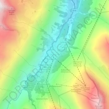
Name: Obergurgl topographic map, elevation, terrain.
Location: Obergurgl, Sölden, Bezirk Imst, Tyrol, 6456, Austria (46.85038 11.00750 46.89038 11.04750)
Average elevation: 7,625 ft
Minimum elevation: 5,896 ft
Maximum elevation: 10,148 ft
Thank you for supporting this site ❤️
Make a donation
Make a donation
Gear up for your next adventure:
As an Amazon Associate, this site earns from qualifying purchases at no extra cost to you.