
Thank you for supporting this site ❤️
Make a donation
Make a donation
Gear up for your next adventure:
As an Amazon Associate, this site earns from qualifying purchases at no extra cost to you.
Niugan topographic map
Click on the map to display elevation.
Thank you for supporting this site ❤️
Make a donation
Make a donation
Gear up for your next adventure:
As an Amazon Associate, this site earns from qualifying purchases at no extra cost to you.
About this map
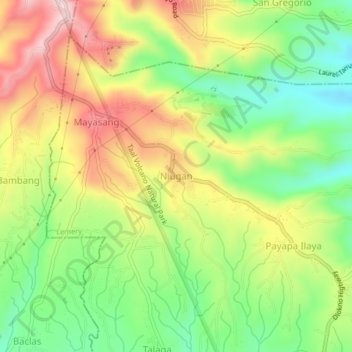
Name: Niugan topographic map, elevation, terrain.
Location: Niugan, Lemery, Batangas, Calabarzon, 4209, Philippines (13.98984 120.85310 14.02984 120.89310)
Average elevation: 1,132 ft
Minimum elevation: 702 ft
Maximum elevation: 1,644 ft
Thank you for supporting this site ❤️
Make a donation
Make a donation
Gear up for your next adventure:
As an Amazon Associate, this site earns from qualifying purchases at no extra cost to you.