
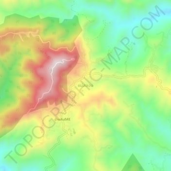
แม่สลอง topographic map
Interactive map
Click on the map to display elevation.
About this map
Name: แม่สลอง topographic map, elevation, terrain.
Location: แม่สลอง, อำเภอแม่ฟ้าหลวง, Provincia de Chiang Rai, Tailandia (20.14284 99.60576 20.18284 99.64576)
Average elevation: 3,396 ft
Minimum elevation: 2,595 ft
Maximum elevation: 4,478 ft