
Hutten topographic map
Interactive map
Click on the map to display elevation.
About this map
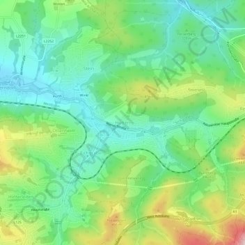
Name: Hutten topographic map, elevation, terrain.
Average elevation: 1,155 ft
Minimum elevation: 833 ft
Maximum elevation: 1,814 ft
Other topographic maps
Click on a map to view its topography, its elevation and its terrain.
Mauerbach
Österreich > Niederösterreich > Bezirk St. Pölten
Mauerbach, Bezirk St. Pölten, Niederösterreich, 3001, Österreich
Average elevation: 1,188 ft