Sint-Lievens-Esse topographic map
Interactive map
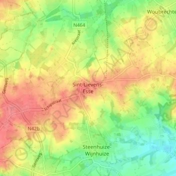
Click on the map to display elevation.
About this map
Name: Sint-Lievens-Esse topographic map, elevation, terrain.
Average elevation: 200 ft
Minimum elevation: 89 ft
Maximum elevation: 295 ft

Click on the map to display elevation.
Name: Sint-Lievens-Esse topographic map, elevation, terrain.
Average elevation: 200 ft
Minimum elevation: 89 ft
Maximum elevation: 295 ft