
Masisea topographic map
Interactive map
Click on the map to display elevation.
About this map
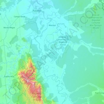
Name: Masisea topographic map, elevation, terrain.
Location: Masisea, Provincia de Coronel Portillo, Ucayali, Perú (-9.68421 -74.53255 -8.33674 -72.93999)
Average elevation: 853 ft
Minimum elevation: 446 ft
Maximum elevation: 7,992 ft