
Parc Océanie topographic map
Interactive map
Click on the map to display elevation.
About this map
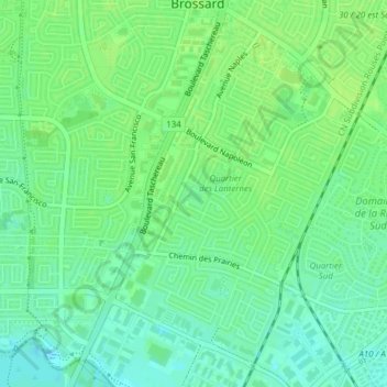
Name: Parc Océanie topographic map, elevation, terrain.
Average elevation: 62 ft
Minimum elevation: 36 ft
Maximum elevation: 79 ft
Other topographic maps
Click on a map to view its topography, its elevation and its terrain.
Parc Briand
Parc Briand, B, Brossard, Longueuil (agglomeration), Montérégie, Québec, Canada
Average elevation: 75 ft