Geolocate

Berne topographic map

Click on the map to display elevation.

About this map

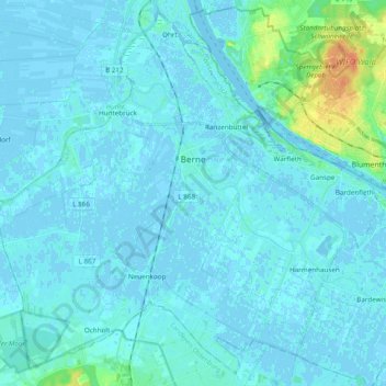
Name: Berne topographic map, elevation, terrain.

Location: Berne, Landkreis Wesermarsch, Lower Saxony, 27804, Germany (53.11900 8.38618 53.22732 8.57856)

Average elevation: 10 ft

Minimum elevation: -10 ft

Maximum elevation: 102 ft

Gear up for your next adventure:

👟Men's Trail Runners - Lightweight footwear for fast-paced exploration and light hiking
🛶Inflatable Kayak - Portable kayak for rivers, lakes, and expeditions
🧦Hiking Socks - Comfortable socks to prevent blisters on long hikes
🎒Trail Energy Bars - High‑calorie bars for hiking energy
🛡️Insect Repellent - Protection against bugs during outdoor activities

As an Amazon Associate, this site earns from qualifying purchases at no extra cost to you.