
San Francisco topographic map
Interactive map
Click on the map to display elevation.
About this map
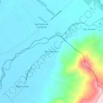
Name: San Francisco topographic map, elevation, terrain.
Location: San Francisco, Zapotal, Ventanas, Los Ríos, Ecuador (-1.31922 -79.35976 -1.27922 -79.31976)
Average elevation: 420 ft
Minimum elevation: 161 ft
Maximum elevation: 1,814 ft
Other topographic maps
Click on a map to view its topography, its elevation and its terrain.
San Luis de Zapotal
Ecuador > Los Ríos > Ventanas > Zapotal
San Luis de Zapotal, Zapotal, Ventanas, Los Ríos, Ecuador
Average elevation: 207 ft