
Venta de Ballerías topographic map
Interactive map
Click on the map to display elevation.
About this map
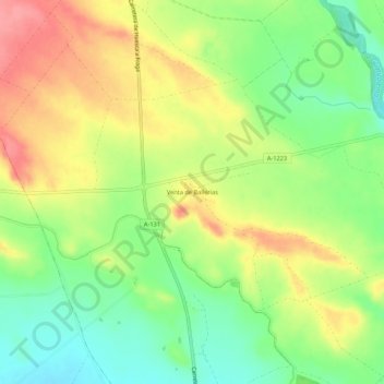
Name: Venta de Ballerías topographic map, elevation, terrain.
Location: Venta de Ballerías, Huerto, Los Monegros, Aragón, España (41.88201 -0.17588 41.92201 -0.13588)
Average elevation: 1,152 ft
Minimum elevation: 1,014 ft
Maximum elevation: 1,309 ft
Other topographic maps
Click on a map to view its topography, its elevation and its terrain.
Usón
España > Aragón > Los Monegros > Huerto
Usón, Huerto, Los Monegros, Aragón, 22212, España
Average elevation: 1,404 ft