
Elmwood topographic map
Interactive map
Click on the map to display elevation.
About this map
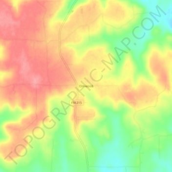
Name: Elmwood topographic map, elevation, terrain.
Location: Elmwood, Anderson County, Texas, United States (31.89961 -95.65107 31.93961 -95.61107)
Average elevation: 591 ft
Minimum elevation: 420 ft
Maximum elevation: 715 ft
Other topographic maps
Click on a map to view its topography, its elevation and its terrain.
Frankston
United States > Texas > Anderson County
Frankston, Anderson County, Texas, United States
Average elevation: 430 ft
Palestine
United States > Texas > Anderson County
Palestine, Anderson County, Texas, United States
Average elevation: 446 ft
Elkhart
United States > Texas > Anderson County > Elkhart
Elkhart, Anderson County, Texas, United States
Average elevation: 384 ft