
Sulzbach topographic map
Interactive map
Click on the map to display elevation.
About this map
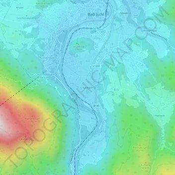
Name: Sulzbach topographic map, elevation, terrain.
Location: Sulzbach, Eck, Bad Ischl, Bezirk Gmunden, 4820, Österreich (47.67477 13.60116 47.71477 13.64116)
Average elevation: 2,090 ft
Minimum elevation: 1,516 ft
Maximum elevation: 4,554 ft