
Jdour topographic map
Interactive map
Click on the map to display elevation.
About this map
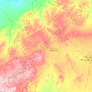
Name: Jdour topographic map, elevation, terrain.
Average elevation: 1,263 ft
Minimum elevation: 561 ft
Maximum elevation: 1,896 ft
Other topographic maps
Click on a map to view its topography, its elevation and its terrain.
Ighoud
Ighoud, caïdat de Ighoud, cercle de Ahmar, Province de Youssoufia, Marrakech-Safi, 46052, Maroc
Average elevation: 997 ft